

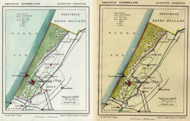
In de details schuilen wat kleine verschillen, maar die hebben meer te maken met de scherpte van de scan, dan met de geografische werkelijkheid. beide kaarten zijn te koop op ebay. De verkoper heeft nog een mooie toelichting:
These scarse detailed maps of Dutch Towns originate from the ‘Gemeente-atlas’ of Jacob Kuyper. These maps are also known as a Kuyper Kaart. This atlas of all towns in the Netherlands was published from 1865-1870 and also included towns in the Dutch province of Zuid-Holland such as: Nieuwland, Nieuw Lekkerland, Nieuwpoort, Nieuwveen, Noordeloos, Noordwijk, Noordwijkerhout, Nootdorp, Numansdorp, Oegstgeest, Ooltgensplaat, Barendrecht, Oostvoorne, Ottoland, Oud Alblas, Oud Beijerland, Ouddorp, Ouderkerk, Oudenhoorn, Oude Tonge en Oudewater. These Zuid-Holland townships often contain smaller villages.
Author: Jacob Kuyper: He was one of the most important of the Dutch atlas editors of the second half of the 19th century. He is particularly known for the “Gemeente Atlas”, with 1210 plans of all the towns and villages in the Netherlands, so called Kuyper Kaarten.
